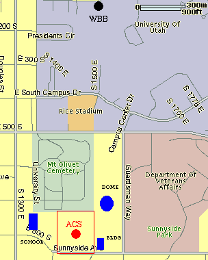
The schematic map shows localization of the site. The north part of the site limited by the cemetery with sparsely distributed trees of 15m height. Distance between threes is about 15-20m. Sunnyside Ave. limits the south part of the site closed by a wire fence. On the other side of the street there are several two floor individual houses with some trees between them. The west side of the site is separated by wired fence from the school stadium and school building. The school and stadium are down the slope (7.4% inclination). They elevation is about 12m below base of the site . At the east side there is open field closed by wired fence. However, in the north corner there is a dome about 15m high and 50m long and in the south-east corner the Nat. Guard building. It is about 30m long and15m high. The site is about 1.6km appart from the WBB buliding of the U. of U.
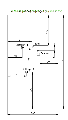
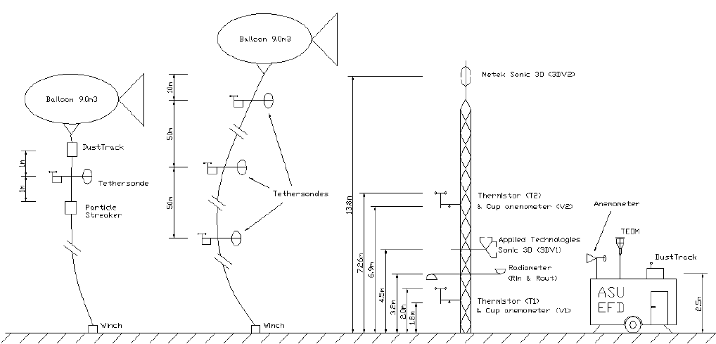
Location of the main instrumentation within the ACS site: balloon1 (tether sondes), balloon2 (tether sonde, DustTrack and Streaker), trailer (TEOM with anemometer), the meteo tower with 2 sonics, 2 cup anemometers, 2 termistors and 2 radiometers (in, out). Distances in meters measured using GPS. The MT coordinates are: North 40.75315, West 111.84864, Height 1410m.